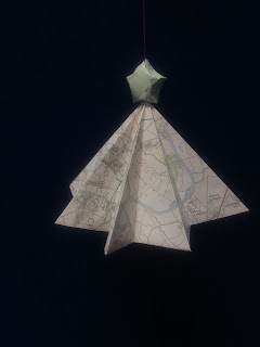
We don’t know what it is about maps…we just love them! Maybe
it’s the Geographer within us or maybe we just like exploring new places but the
tutor team at FSC Preston Montford definitely have a soft spot for those paper
diagrams. Maps help you to plan your outings, help get you back on route when
you have made a wrong turn (it happens to the best of us), warn you about
hazards or just how steep the hill round the next corner will be and they even
make great works of art.
National Map Reading week was from the 16th to 22nd
October and was a reminder of how often we use maps.
As tutors we use maps in many of our sessions, particularly
during our GSCE downstream river introductions where we assess why Carding Mill
Valley is a suitable location for our study and what the key characteristics
are in the landscape. We guide the students to read the contour lines, use the
scale and identify key symbols.
 |
| Carding Mill Valley river study. |
At Cwm Idwal, Snowdonia, we use Ordnance Survey maps to
orientate the students and help them to enter a magical place – one of ice ages
past and a land of giants. Additionally with our A level groups, we use
compasses at Cwm Idwal to calculate striation orientation.
 |
| Measuring striations. |
 |
| The wild glacial landscape of Cwm Idwal, Snowdonia. |
During our KS2 Stiperstones Stomp day, we encourage our
young adventurers to navigate sections of the route over the heathland – taking
the lead but also teaching them the importance of not leaving anyone behind. We
also use maps in urban areas, to direct student to set fieldwork locations and
to complete land use mapping on tablets. Many of our evening sessions use
Geographical Information Systems (GIS) to geolocate data and allow for analyse
in relation to the surrounding environment.
 |
| Stiperstones Stomp route card - Part 1 of 4. |
 |
| One of many rocky outcrops surrounded by purple heather on The Stiperstones. |
We use maps on all of our Site Working Information Cards
(SWICs), which are site specific risk assessments. The maps help direct people
to the site, identify key hazards and hold important emergency information. The
tutor team, including our associate tutors, carry copies of relevant SWICs when
we are offsite. You can find many of them via the following link: http://www.field-studies-council.org/centres/prestonmontford/learn/schools/info-for-teachers/our-risk-assessments.aspx.
Finally, we use maps on our days off too. Many of the FSC
Preston Montford team enjoy walking in their free time, two of our tutors have
separately completed long distance walks in the last 18 months– the Jurassic
Coast and the West Highland Way. One of us is an orienteering competition
participant, one seeks out new places to wild camp, several of us have undergone
Mountain Leader or Hill & Moorland training and a few of us enjoy recycling
old maps into decorations. Collectively we have a great deal of map reading
knowledge but we always seek to improve and keep our skills fresh.
 |
| Decoration created by Angela Munn. |
To find out more about how you can improve your own map
reading skills explore the following link: https://www.ordnancesurvey.co.uk/getoutside/guides/map-reading-week/
All images, with the exception of the Stiperstones Stomp route card - Part 1 of 4, were taken by Charlotte Timerick.
No comments:
Post a Comment